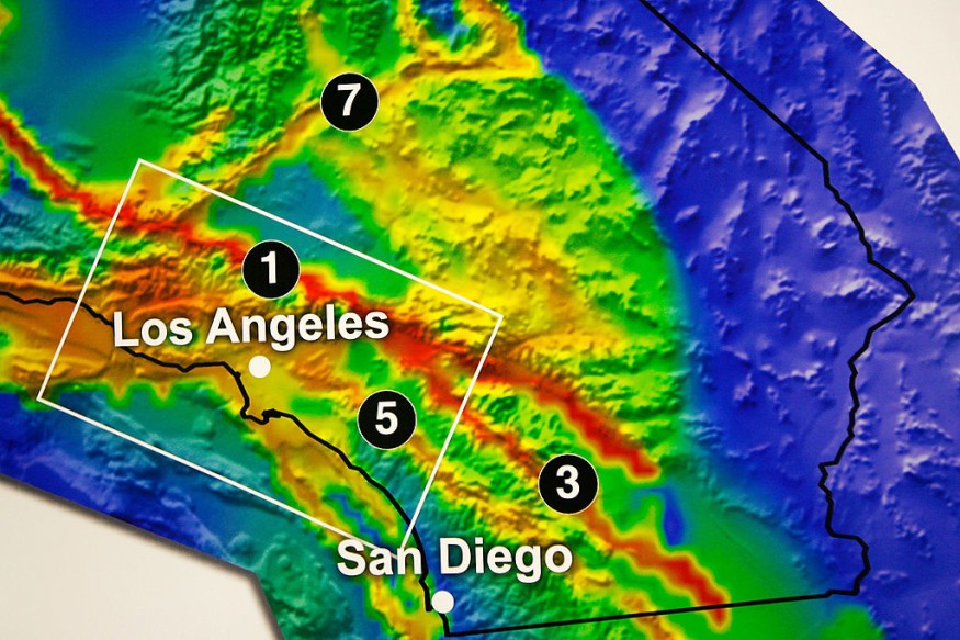
According to the U.S. Geological Survey (USGS), a 3.8 magnitude earthquake was experienced throughout the Los Angeles region on early Sunday morning, July 2. The earthquake occurred at 2:29 a.m., and its epicenter was located about 13 miles southwest of Malibu, off the coast.
People reported feeling the quake in various areas, ranging from Ventura to the San Diego County line, across the San Fernando Valley, and even as far inland as Ontario.

USGS Map of Recent Los Angeles Earthquake
According to the local report by KTLA 5, the earthquake's initial magnitude was reported as 4.1, but it was soon revised to 3.8. Shaking from the tremor extended across Los Angeles County and parts of Ventura, Orange, and Santa Barbara counties, as indicated by a USGS map. Fortunately, there were no injuries or damage reported, and fire crews did not express concern about the infrastructure.
Due to its relatively small size, the earthquake did not trigger automatic cell phone alerts. USGS officials advised residents who felt the shaking to take protective measures like "Drop, Cover, and Hold On."
While California records tens of thousands of earthquakes annually, the vast majority are of minor intensity. Only several hundred earthquakes reach a magnitude greater than 3.0, and approximately 15 to 20 are of magnitude 4.0 or higher, according to the USGS. California ranks second to Alaska in the United States for the number of earthquakes recorded each year.
READ ALSO : What the 7.8-Magnitude Earthquake in Turkey and Syria Could Teach the World in Terms of Disaster Response
Risk of Los Angeles Getting Hit by an Earthquake
When contemplating earthquakes in Los Angeles, most people immediately associate them with the Southern San Andreas fault. According to the California Earthquake Authority, this fault resulted from the North American plate consuming a significant portion of the Farallon plate 30 million years ago. Since then, the North American plate has been sliding against the Pacific plate along a strike-slip fault boundary.
Running along the northern side of the San Gabriel Mountains in Los Angeles County, the Southern San Andreas fault is the longest fault in California and has the potential to generate powerful earthquakes, reaching magnitudes as high as 8.
Based on a 30-year timeframe commencing in 2014, there is a 75% probability of one or more magnitude 7.0 or greater earthquakes striking Southern California.
Additionally, Los Angeles experiences earthquakes on less prominent faults. In 2019, the Ridgecrest earthquakes occurred, marking the most significant seismic events in California in over two decades. These earthquakes, with magnitudes of 6.4 and 7.1, struck southwest of Searles Valley and unleashed a force equivalent to 45 nuclear bombs in the Mojave Desert.
In Los Angeles County, earthquakes occur regularly, mostly mild or moderate with limited damage. However, every few years, an earthquake of magnitude 6.0 or more is projected to impact Southern California.
Seismologists, including Lucy Jones, warn that the impact of such an earthquake could be severe if it occurs on faults within metropolitan areas, like Hollywood. These faults run through densely populated regions with thousands of buildings, posing a significant risk to millions of people.
The potential damage could involve destroyed freeways, fires from broken gas lines, disruptions to the water supply, and extended outages of high-voltage power lines, leaving Southern California without electricity for days. CoreLogic forecasts that a rupture along the Southern San Andreas Fault may threaten 3.5 million properties, with a total rebuilding value of $289 billion.
RELATED ARTICLE: Significant Magnetic Field Shift Occurred in the San Andreas Magnetic Field Prior to an Earthquake [STUDY]
Check out more news and information on Earthquake in Science Times.


