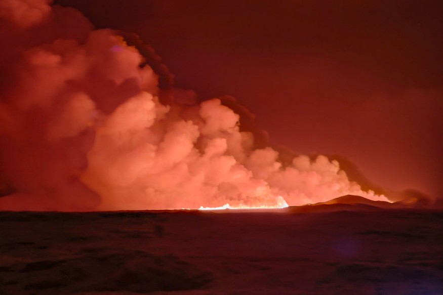
An Iceland volcano has just erupted weeks after frequent quakes rocked the region.
Iceland Volcano Erupts
The eruption is taking place on the southwestern Reykjanes peninsula. The Iceland Met Office officially reported that the eruption has begun north of Grindavik, adding that it was visible on webcams and appears to be situated near Hagafell.
The volcano started erupting at 22:17 (5:17 PM EST) after the swarm of earthquakes that began at roughly 21. The Met Office also reported plans for a coast guard helicopter to be deployed in order to confirm the eruption's exact location and size.
The Met Office also reported that seismic activity along with GPS device measurements show that the magma has a southwest direction and that the volcanic eruption may persist in Grindavik's direction. The office added that the crack in the surface was roughly 3.5 kilometers in length and had rapidly grown. Up to 100 to 200 cubic meters of lava emerged each second, making it several times more compared to earlier eruptions in the region.
With the eruption, roughly 4,000 individuals had to evacuate from Grindavik, which is a fishing village within the peninsula. Authorities were also forced to close down the Blue Lagoon geothermal spa.
The Keflavik International Airport near the peninsula remained open amidst several departure and arrival delays.
Volcanic Activity Cycle in the Reykjanes Peninsula
The strong eruption comes as part of a volcanic activity cycle in the Reykjanes peninsula that spans 1,000 years. Researcher Edward W. Marshall from the Nordic Volcanological Center at the University of Iceland also explains that the eruption shows that the area will likely experience more volcanic eruptions for centuries.
Since October, hundreds of earthquakes every day have been rattling the area. This prompted scientists to consider the possibility of an imminent eruption. Due to eruption fears, Grindavik was excavated on November 10.
From December 12 to 15, a total of 460 earthquakes hit the region. Among these, 30 quakes had magnitudes that exceeded 1.0.
The country itself is situated between the North American and Eurasian tectonic plates, which are some of the planet's largest. This makes Iceland a volcanic and seismic hotspot as both plates move in opposing directions.
In recent years, the Reykjanes peninsula has seen multiple eruptions in unpopulated regions. In March 2021, eruptions of lava fountains surfaced from a ground fissure that spanned 500 to 750 meters in length. This was in the Fagradalsfjall volcanic system of the region. Volcanic activity went on for six months that year. This prompted several tourists and Icelanders to check the area out.
In August 2022, an eruption that lasted three weeks also took place in the area. Another one took place just last July.
Check out more news and information on Environment & Climate in Science Times.


