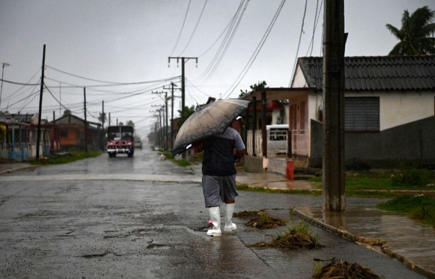
Recent reports said tropical storm Ida has gained strength and is forecasted to turn into a dangerous Category 3 hurricane.
According to a Space.com report, the National Hurricane Center yesterday warned that the storm had strengthened more as it is barreling through the Caribbean Sea, and when it hits the northern Gulf Coast Sunday, it is expected to become a "dangerous major hurricane.
With an assumption that Ida is following its forecasted path, it could hit exactly when Hurricane Katrina made landfall 16 years ago, in 2005, near New Orleans.
The NHC also announced a hurricane watch is currently in effect between Louisiana, Cameron, and the Mississippi-Alabama border and in the Lake Pontchartrain, Lake Maurepas, and metropolitan New Orleans.
ALSO READ : NASA Takes Purdue Team Miles Above Earth up to 70,000 Feet; To Study Atmospheric, Planetary Science

Life-Threatening Storm Surges Expected
As Storm Ida comes closer, life-threatening storm surges could take place from the Sabine Pass, at Texas and Louisiana's border, to the border of Alabama and Florida.
Also under storm surge, watches are Vermilion Bay, Lake Pontchartrain, Lake Borne, Mobile Bay, and Lake Maurepas. According to the NHC, if peak surges accord with high tide, they then could reach as high as 3.3 meters or 11 feet above ground level between Morgan City, Louisiana, and Ocean Springs, Mississippi in the region.
Tropical-storm-force winds are presently extending up to a maximum of 145 kilometers from the approaching cyclone's center.
The NHC also said that once storm ID hits the United States, Tropical Storm Conditions could occur anywhere between the Mississippi-Alabama border and the Alabama-Florida border.
Heavy Rains Ahead
Ida could bring approximately eight to 16 inches or 20 to 41 centimeters of rainfall to areas between southeast Louisiana to coastal Mississippi and Alabama, with remote sites getting a maximum of 20 inches or 51 centimeters of rain.
This means that heavy rains are expected to last until Monday morning, August 30. As tropical storm Ida moves inland, it could bring roughly four to eight inches or 10 to 20 centimeters of rain to southern and central Mississippi.
ABC News report specified that according to Benjamin Schott, during a news conference with Louisiana Governor John Bel Edwards on Friday, this will be a life-changing storm for people who are not prepared.
The report also said the governor urged the residents to prepare quickly, saying by nightfall the following night, people would need to be where they intend to be "to ride out the storm."
Category 3 in Hurricanes
The NHC defines a major hurricane as a Category 3 or even higher, which means that Ida could attain maximum sustained winds of 178.6 kilometers per hour or greater by the time it hits the Louisiana coast. If this happens, Ida would be the fourth hurricane of this year's Atlantic season.
Currently, the storm is forecasted to hit Louisiana as a Category 3, which has maximum sustained winds of around 185 kilometers per hour.
In a 2019 report, news agency Time said with Category 3; there is a great danger of injury or fatality to humans, pets, and livestock from flying and falling debris.
Almost all older mobile homes will be ruined, and most new ones are to experience substantial damage. Even well-constructed frame homes, industrial buildings, and apartments are likely to experience major damage.
The storm under Category 3 will uproot many trees as well, which may block roads. Lastly, electricity and water are likely to be unavailable for several days to a couple of weeks following the storm.
Related report about storm Ida is shown on ABC 13 Houston's YouTube video below:
RELATED ARTICLE: Massive Elsa Hits Lesser Antilles, First Atlantic Hurricane of 2021 Came Earlier Than Expected
Check out more news and information on Environment and Climate in Science Times.


